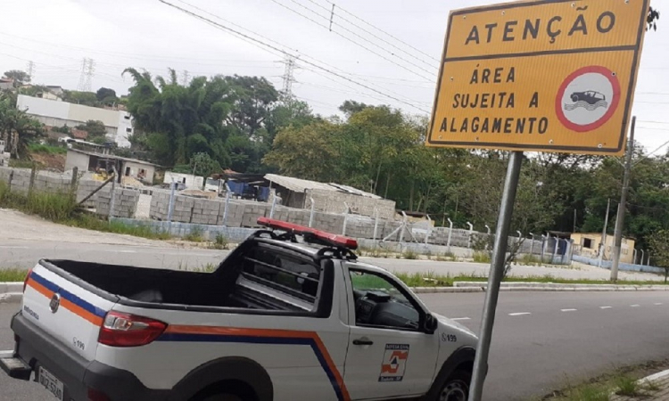
Londres, Copenhague e Nova York implementaram tecnologias avançadas para ajustar semáforos em tempo real e otimizar o transporte público; em Paris, a IA auxilia no planejamento de espaços verdes
Freepik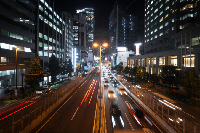 IA está transformando a maneira como nossas cidades são planejadas e gerenciadas
Jovem Pan > Opinião Jovem Pan > Comentaristas > Helena Degreas > Descubra como a inteligência artificial já impacta o futuro das nossas cidades
Descubra como a inteligência artificial já impacta o futuro das nossas cidades
Londres, Copenhague e Nova York implementaram tecnologias avançadas para ajustar semáforos em tempo real e otimizar o transporte público; em Paris, a IA auxilia no planejamento de espaços verdes
- Por Helena Degreas para a Jovem Pan News
- 31/07/2024 11h37 – Atualizado em 31/07/2024 11h38
Freepik
IA está transformando a maneira como nossas cidades são planejadas e gerenciadas
A inteligência artificial (IA) já não é mais coisa de outro mundo ou de ficção científica. Se você observar, ela está presente em nossos smartphones, carros e até mesmo em nossos eletrodomésticos. Mas você sabia que a IA também está transformando a maneira como nossas cidades são planejadas e gerenciadas? Imagine cidades onde semáforos inteligentes ajustam o tempo de acordo com o fluxo de tráfego de pessoas e automóveis, reduzindo congestionamentos, facilitando a travessia de pedestres e melhorando a qualidade do ar em ruas e bairros onde os indicadores apontam para a necessidade de restrição da circulação de veículos. Ou prédios que otimizam o uso de energia, diminuindo o impacto ambiental e os custos para os moradores. Essa é a realidade que a IA está construindo em cidades que se destacam pelo relatório IESE Cities in Motion Index (CIMI) como inteligentes e encontram-se ranqueadas.
Recentemente, li uma coluna na newsletter Bloomberg intitulada “OpenAI Scale Ranks Progress Toward ‘Human-Level’ Problem Solving” (em tradução livre, “A Escala da OpenAI Avalia o Progresso em Direção à Solução de Problemas em Nível Humano”, que abordou o conceito de Inteligência Artificial Geral (AGI). A AGI refere-se a sistemas inteligentes com capacidade cognitiva equivalente ou superior à humana em diversas tarefas. Diferentemente da IA especializada, projetada para tarefas específicas, a AGI pode compreender, aprender e aplicar conhecimento de forma abrangente, adaptando-se a novos desafios e contextos sem necessidade de reprogramação. Imagine o impacto que a substituição de decisões humanas, muitas vezes baseadas em suposições ou dados incompletos, pode ter na qualidade de vida dos cidadãos.Playvolume
A AGI tem o potencial de transformar radicalmente o planejamento urbano e a gestão pública. Com sua capacidade de análise abrangente e em tempo real de dados complexos, a AGI pode melhorar significativamente a eficiência e eficácia das políticas públicas. Ela pode otimizar o tráfego, gerenciar a distribuição de recursos, prever e mitigar desastres naturais e aprimorar a prestação de serviços públicos. Além disso, a AGI pode analisar feedbacks da população para criar soluções mais inclusivas e democráticas, levando a cidades mais inteligentes, sustentáveis e equitativas.
Esses exemplos mostram como a inteligência pode transformar a gestão urbana a partir de cinco níveis de desenvolvimento previstos pela OpenAI. No nível básico, a automação simples realiza tarefas repetitivas, como a coleta de lixo ou o controle de tráfego. Assistentes virtuais podem ser utilizados em centros de atendimento ao cidadão, fornecendo informações e serviços de forma rápida e eficiente. Análises preditivas permitem aos gestores urbanos prever e mitigar problemas antes que eles ocorram, como congestionamentos ou falhas em infraestruturas. A autonomia parcial da IA pode ser utilizada para gerenciar sistemas complexos, como redes de transporte ou distribuição de energia, ajustando-se dinamicamente às mudanças nas condições. No nível mais avançado, sua autonomia completa pode permitir a operação de veículos autônomos e a gestão integrada de todas as infraestruturas urbanas, otimizando o uso de recursos e melhorando a qualidade de vida dos cidadãos.
A gestão municipal hoje é baseada em dados. Esses dados são capazes de gerar um volume imenso de informações úteis, medidas em yottabytes, com o objetivo de levar conhecimento da realidade em todas as áreas relacionadas à prestação de serviços públicos. O relatório do IESE (CIMI) utiliza nove dimensões para avaliar o nível de inteligência de uma cidade e dados de mais de 100 indicadores para compor o ranking. A AGI tem o potencial de transformar radicalmente o planejamento urbano e a gestão pública. Com sua capacidade de análise abrangente e em tempo real de dados complexos, ela pode melhorar a eficiência e eficácia das políticas públicas, otimizando a resolução de problemas não previstos por agentes públicos.
Essas questões estão relacionadas a áreas como Capital Humano, Coesão Social, Economia, Governança, Meio Ambiente, Mobilidade e Transporte, Planejamento Urbano, Projeção Internacional e Tecnologia. Para quem se interessar pelo tema, o artigo “Artificial General Intelligence is Already Here”, de Aguera y Arcas e Norvig, publicado na Noema em outubro de 2023, oferece uma análise mais detalhada sobre o tema. Para implementar essas tecnologias, os gestores públicos precisam preparar e investir na infraestrutura urbana. Isso inclui a instalação de sensores e dispositivos de IoT (Internet das Coisas) para coletar dados em tempo real, além de garantir conectividade de alta velocidade e baixa latência, como redes 5G. É necessário também investir em servidores de alto desempenho e infraestrutura de nuvem para processar grandes volumes de dados. A segurança cibernética é outro aspecto a ser considerado, com a implementação de protocolos robustos para proteger os dados e sistemas contra ataques. Políticas públicas devem ser geradas com menos ideologia e mais precisão.
O IESE Cities in Motion Index (CIMI) destaca como cidades como Londres, Copenhague e Nova York implementaram tecnologias avançadas para ajustar semáforos em tempo real, otimizar rotas de transporte público e planejar de forma mais eficiente. Em Paris, a IA auxilia no planejamento de espaços verdes e na otimização do uso de energia em edifícios, criando um ambiente urbano mais sustentável e agradável. Em Oslo, sensores inteligentes monitoram a qualidade do ar e da água, permitindo ações rápidas em caso de problemas ambientais. Em cidades como Estocolmo e Barcelona, a IA está sendo utilizada para facilitar a participação cidadã, onde plataformas digitais permitem que os moradores se envolvam ativamente no processo de tomada de decisão, contribuindo com ideias e feedbacks para o desenvolvimento urbano.
Ainda na mesma coluna, Elon Musk sugere que a IA poderia superar a inteligência dos seres humanos mais inteligentes até 2025 ou 2026, mencionando que a quantidade total de “computação senciente” superaria a de todos os humanos em cinco anos. Musk enfatizou a importância de desenvolvimento responsável de tecnologias artificiais que garantam que seu impacto seja benéfico para a sociedade como um todo. A computação senciente, ou a criação de sistemas capazes de percepção consciente (capacidade de perceber e responder ao ambiente), autoconsciência (reconhecer-se como uma entidade distinta de outras), sentimentos e emoções (reagir com profundidade emocional para além da programação) e tomada de decisões independentes (baseadas em um entendimento consciente das situações), ainda é uma perspectiva teórica, mas pode ter impactos profundos no planejamento urbano, pois poderia tomar decisões considerando não apenas dados objetivos, mas também o bem-estar emocional e social dos cidadãos. Isso poderia levar a um planejamento urbano mais justo e equitativo, onde as necessidades de todos os grupos sociais são atendidas de forma equilibrada.
Ainda temos um longo caminho a percorrer, mas o planejamento das ações que visam rever rotinas e processos da gestão pública para a melhoria da qualidade das decisões de prefeitos, secretários, vereadores e demais agentes públicos depende do plano de gestão urbana. Cabe a nós, cidadãos, cobrar dos candidatos um planejamento eficaz voltado à melhoria da qualidade de vida de todos. O futuro se constrói agora.
Tem alguma dúvida ou quer sugerir um tema? Escreva para mim no Twitter ou no Instagram: @helenadegreas
*Esse texto não reflete, necessariamente, a opinião da Jovem Pan.