Systems of free open spaces and the constitution of the contemporary public sphere in Brazil: land use and social sustainability
Degreas, Helena Napoleon¹; Macedo, Silvio Soares² ¹ PhD in Landscape Architecture, Professor and researcher of the Department of Architecture and Urban Planning of FIAMFAAM; member of the research hosted in FAUUSP-QUAPA ² PhD in Landscape Architecture, Titular Professor of the Department of Landscape and Environment of the College of Architecture and Urban Planning of the University of São Paulo and leader of the national research “System of free spaces and the constitution of the contemporary public sphere in Brazil”
Abstract
This article present a vision of the Brazilian cities considering the production of their system of open spaces that results in new urban patterns, showing the importance of this new approach in the constitution of the contemporary public sphere in Brazil and its importance to the construction of sustainable cities. The article also adopts free open space as the organizing element of the urban landscape, responsible for the diverse morphologic, environmental, aesthetic and functional aspects of the cities. These spaces are elements basic to the performance of social life, because in them occur the leisure, the recreation, the social encounters and the conservation of the natural elements propitiating quality of public life. An intense urbanization process based on the model of “ideal city” toke place in our country but it did not work in Brazil, predominating informal pattern of urbanization, creating the unsustainable city pattern we have today: informal cities that devoid of basic infrastructure and of public equipment showing in its landscapes the results of socio-economic disparities proceeding from a spontaneous manner and shunning urban standards and legal norms. This article is part of the national research program : “System of free open spaces and the constitution of the contemporary public sphere in Brazil ” , supported by FAPESP and led by Silvio Macedo, PhD. Created in August of 2006, it congregates innumerable nuclei of research in university institutions distributed throughout Brazil. It is hosted in the Department of Landscape and Environment of the College of Architecture and Urban Planning of the University of São Paulo.
Keywords: landscape and social sustainability, new urban patterns, legislation.
1 Introduction
During the last few decades of the twentieth century Brazilian cities passed through a rapid process of urbanization coinciding with the end of an accelerated expansion of the economy. Until the 1960s, the urban population in Brazil represented about 45% of the national total. Forty years later, this number reached 80%, taking more than 100 million new inhabitants to the urban centers. These numbers, when associated with a precarious process of urban planning, produced a series of problems in the organization of the land and the distribution of its infrastructure, building social injustices and inequalities into its landscapes.
Coming from an agricultural background, with low levels of instruction and sparsely qualified for formal work in urban areas, the new inhabitants started to illegally occupy the poorly structured outskirts, the environmentally fragile areas such as steep hillsides and valley floors, areas subject to flooding such as fens and riversides, and wooded areas. From then on, urban precariousness spread as a settlement standard, exposing the historic inability of the public authorities to create housing policies capable of attending the housing needs of the low income population. Throughout the country, on one hand appears the city endowed with infrastructure; on the other, the illegal city neglected by their government.
By persistently creating public policies, government programs, projects and interventions in the territories of the legally occupied city, while denying the existence of the urban informality, the city was divided into two groups: the rich city endowed with infrastructure and public equipment and the poor city, of precarious urbanization, whose population has no access to the opportunities of education, health, transport, housing, work and leisure. This situation generated economic valuation, transforming the urban territory into a real estate business. The citizen who has financial resources lives in the legalized city, whose public infrastructure is installed. Those who do not have sufficient resources to pay for a regularized lot, invade the peripheral areas, commercialized illegally by clandestine property salesmen, who sell environmentally fragile areas and publicly owned lands, often originally destined for the implantation of urban equipment such as hospitals, schools, police stations, squares and low-investment parks, making the urban territory extend itself indefinitely, creating illegality and the precariousness of occupation.
2 Towards a sustainable urban planning process: quality of living in Brazilian cities
The Federal Constitution of 1988 included a specific chapter under Heading VII – Of the Economic and Financial Order- that deals with urban public policies. In it, issues are defined relating to the municipal managing plan, to urban property, to the dispossession of property in the cities and to the right of the municipal Public Power to demand the adequate use of urban lots by its proprietors. From this point, a specific and nation-wide legislation was created, that defined and allowed the application of flexible measures by means of legal and administrative instruments to the reality of the informal cities, permitting the regularization and organization of the dwelling places of a great part of the Brazilian population.
It can be affirmed that in Brazil, urban environment sustainability must be procured through a constant search that is only attained by means of a planning process that integrates the plans and action of the diverse instances of government, subordinating the actions of the state to the collective interests and to the construction of citizenship. A citizenship that not only aims at the satisfaction of the minimum basic necessities of a human being, but also seeks the quality of the individual and collective urban life.
3 Legal background for the promotion of change: the Statute of the City
With the objective of carrying out, at the municipal level, the urban policies that are dealt with in articles 182 and 183 the Constitution of the Federative Republic of Brazil, the Law nº 10,257, of July 10, 2001, called Statute of the City, was passed. In it the norms of public order and social interest are established, that regulate the use of urban property in favor of the collective good, of the security and welfare of the citizens, as well as of the environmental equilibrium, guaranteeing the right to sustainable cities. These articles prescribe the obligatory creation and approval of a municipal managing plan as basic instrument of the politics of development and urban expansion for the cities with more than twenty thousand inhabitants.
Figure 1: Brazilian informal cities (QUAPA, 2006)
Through the ordering of the social functions of the city and urban property as foreseen in the municipal managing plans, it is intended to prevent and to correct the possible distortions of urban sprawl, inequalities in the provision of infrastructures, degradation and pollution of the environment. Aiming at the sustainability of the cities, the Statute guarantees the right to the organization and control of land use when adopting standards of production, consumption and of urban expansion compatible with the limits of the environmental, social and economic sustainability of its territory by means of the elaboration and regulation of sustainable public politics. In the environmental sphere, the plan points out guidelines for the protection, preservation and recovery of the natural and constructed environment, of cultural, historical, artistic, landscaping and archaeological patrimony. In this way it is hoped that the sustainability of the cities occurs from the availability of, and equitable access to, the right to urban land, housing, environmental sanitation, the urban infrastructure, transport and public services, the opened spaces, work and leisure. These actions intend to meet the needs of present and future generations, adjusting this provision to the real interests and necessities of the population, respecting the limits of urban occupation and densities. One expects that with equitable access, all may have the possibility of developing a productive life, starting from the availability of equal chances for all.
In Brazil, the Statute of the City is considered an innovative law, because it creates the necessary guidelines and planning instruments to make viable an urban reform directed toward the promotion of an equitable and sustainable development of all urban territory considering the environmental, urban and social aspects of the city. Succinctly, the guidelines and instruments are as follows:
– General guidelines for urban policies that guarantee the regularization of real estate and the urbanization of areas illegally occupied by the low income population, by means of the ordinance and control of the use of the land, preventing the speculative retention of urban property.
– Planning instruments destined to assure the social function of the urban property such as the Managing Plan, the division of, and obligatory construction on urban property, slow growth urban property tax, dispossession for ends of urban reform, the right to pre-emption, onerous grant of the right to construct (reclaimed land);
– Instruments of real estate regularization such as the urban processory title, concession of right in rem of use, zones of social interest.
– Instruments of democratic management of the city such as the urban policy councils, conferences of the city, participative budget, public audiences, legislative initiatives by non members of parliament and studies of neighborhood impact.
With this, the accomplishment of the municipal planning conducted by sustainable guidelines must consider the precepts established in federal law guaranteeing urban development, the welfare state and the quality of life of its citizens. The municipal strategic planning is a contemporary management instrument that modifies the traditional form of management that involves a series of complex factors that include the ample knowledge of the territorial physical spaces, of its needs and of its potentialities, the establishment of methodologies, strategies and controls, administration of limited budgets and mainly the popular participation and involvement in the formularization and implementation of the urban projects. Reiterating, this new approach to planning allows the municipal public power to keep the population of the irregular city in its territory, making dialogue and participation possible by means of councils, getting to know its necessities, weaknesses, and making possible the construction of a city of equal opportunities.
In Brazil, the unequal socioeconomic conditions guided the objective of improvement of the quality of life towards the reduction of these disparities by means of the revision of the health politics, education, habitation, security and universalization of access of this population to these services. (Afonso, 2006:62)
Apparently abstract, the concept of quality of life pursued by the strategic municipal planning must be established starting from minimum human survival necessities, inserted in an urban environment. With this, beyond the previously cited policies, new demands such as commerce, transport, work, recreation and leisure are introduced involving new cultural and psychological aspects of the physical, social and psychic well-being of individuals and groups. (Afonso, 2006:68) The urban planning instruments created by the Statute of the City grant the population occupying illegal areas the right to the regulation of the urban property and as a consequence access to the public infrastructure and equipment, thus conferring on them the right to a quality of urban life through the use and enjoyment of the urban space: becoming citizens.
4 The production of Brazilian public space: open space as urban infrastructure and support for public life
The city can be seen and be analyzed through a variety of lenses that can collaborate in the understanding of its complex reality. Under the perspective of sociology, the city is the environment where human relationships have their place. In architecture, these human relationships occur in spaces constructed by man and for man. In ecology, the materialization of things and objects in an artificially constructed environment and whose functioning is fragmented, not systemic, modifies and impacts the natural environment taking it into entropy. For landscape architecture, the city is constructed and perceived by means of its free spaces. Its landscape is perceived and lived deeply by the citizen from the materialization of the relation between what it is built and what is area free of construction. According to Magnoli (1982: 15), the free spaces are the unbuilt: yards, gardens, streets, avenues, squares, parks, rivers, bushes, fens, urban beaches, or simple urban emptiness. Its localization, accessibility and distribution form a complex system of connections with multiple urban roles: free time activities, urban circulation, comfort, environmental conservation and requalification, urban drainage, urban imagery and memory, leisure and recreation, amongst others. They may be public or private.
The research group QUAPA – Picture of Landscaping in Brazil has as study object the Spaces Free of Buildings, understood as sets of public areas and private properties consisting of distinct morphologies and typologies, whose localization and distribution occur in diversified ways throughout all the urban fabric.
The Spaces Free of Buildings are elements or parts of the urban fabric that can be coordinated and contiguous between themselves, generating systems that, by means of the induction generated by public policies, programs, projects and action, lead to connectivity relating them between themselves morphologically, environmentally, functionally or even culturally, constituting a unit that is found to be governed by a systemic logic. The systemic vision provides another view of the contemporary Brazilian city as it relates to and contextualizes urban fragments in its territory, given them new meanings. This “re-signification” can induce different valuations of the same elements, generating new potentials for the use and public appropriation of free spaces which were previously without function, sub-utilized or even degraded.
The research deals with the free space in the public category (with its myriad typologies, forms, uses and functions) and the private category (internal areas within the property) as urban infrastructure responsible for the morphology of the city.
Figure 2: São Paulo: new open spaces proceeding from new urban legislation (QUAPA 2008)
If the city is form in the process of constant construction and reconstruction, the dynamics of daily life of the people creates its content by means of multiple activities and appropriations. We assume that the free space is the place of public life, for social interchange and meetings as it makes possible the percipient experience and daily practice of the relations between the people, giving the city life, theatricality.
Process and social product, the free spaces materialize the time and the necessities of the people who constructed them. In a considerably generalized form, four stages can be cited that morphologically characterized Brazilian cities:
5 The Colonial city and its free open spaces
In the first three centuries of urbanization, Brazil was a simple colony of the Portuguese crown, presenting a process of incipient urbanization which relegated a secondary role to the public free space, considering that it was not the result of a social necessity. In the majority of the Brazilian cities, the private accumulation of wealth defined the political and physical structure of the cities. It was in private property, in the farms that daily and social life was carried out. The sparse and small local population related directly with a luxuriant tropical vegetation and profuse fauna composed by the Atlantic forest that ran the length of the Brazilian coast, where the first urban nuclei if had been installed. Even the cities of Salvador and Rio de Janeiro that were capitals, had some few thousands of inhabitants characterizing themselves as modest agglomerations, true commercial warehouses with humble public free spaces occupied by ambulant peddlers. The main public spaces had basically an institutional influence, that is, the public free spaces were determined by the institution that predominated there in the daily activities of the people. Church and State occupied the squares. The commerce, the manufacture, was situated around it as it characterized the center of the nucleus. Housing in turn surrounded this area forming the residential areas. The activities of social encounters occurred by means of the religious commemorations such as processions. The private spaces of the houses were composed of backyards which, thanks to the poorly developed commerce, represented the space for plantation and subsistence of its inhabitants. It was there that they planted vegetables, fruits, flowers and bred animals for human consumption.
Figure 3: Residential pattern of the 20th century (QUAPA, 2006)
The same occurred in the patios of the convents where the necessity for production of food was more important than that related to the aesthetic attributes of the composition of environments. Except for the city of Recife which had intentional plantation of street arborization and where the first urban park was implanted, in too many cities, the public areas were neglected, accidentally constituted and not always were they paved. Of remaining portion, the nuclei had plazas, leveled places and clearings originating from the informality in the urban production where people, animals and vegetable plots joined.
Figure 4: Pátio São Pedro, Recife (QUAPA 2008)
The vegetation did not appear as an element of prominence or importance in the city. Only in the eighteenth century, in the capital of Rio de Janeiro, the first Public Walk appears, localized on an area of earth fills, this work was done to complement and to improve the linking of the urban nucleus with the more distant regions. In spite of its local character, the construction of a modern free space built in the manner of the Portuguese metropolis, signaled the intention to destine free areas for a new function of urban use: that of recreation for the populace.
6 The industrial city
The first decades of the twentieth century point towards the consolidation of eclecticism as the language assumed by Brazilian urbanism. On the one hand, using Spanish and French references, boulevards are constructed surrounded by terraced buildings, and on the other hand, modern residential quarters appear, derived from the English garden-city. In the latter, the isolated building in the lot interspersed with well-cared for gardens, wide wooded and grassy sidewalks, with winding and romantic formats intermingled with small parks and small greened squares, changed into the dream of consumption for the elites and middle classes of the whole country.
From the 1930s onwards, and with the development of construction techniques, the process of high-rise building in the Brazilian cities initiated using the French configuration of square city blocks. This method of organizing space results in the restriction of private free spaces and these are substituted by internal wells of ventilation within the lots and by urban squares. With modernism the Brazilian landscape architecture passed through a moment of rupture and construction. Rupture because it definitively abandoned eclecticism as the form of urban spatial expression conserving only the practice of maintaining the native vegetation and the use of certain materials for floors such as the Portuguese mosaic. Construction, because the modern Brazilian landscaping architecture was characterized by a strong national identity from the 1940s. In parallel, the habits of use of the free spaces are diversified with the introduction of sporting activities such as soccer, tennis, rowing and swimming that demand the construction of special installations.
Figure 5: Brasília and the end of colonial urban pattern (QUAPA, 2007)
This equipment was constructed throughout the country demanding the installation of grass-covered playing grounds, bocha courts, sports grounds in public free spaces already implanted, such as urban gardens, plazas, squares and parks. Swimming pools appeared in the well-to-do residences, becoming popular in the 50s and 60s and becoming a status symbol for those that possessed one. At the same time playgrounds appeared, a North American creation that concentrates a set of prefabricated toys in specific parts of the free spaces, in general public and directed towards recreation. The high cost of the urban land and the reduction of the playing areas of backyards led to a situation of chronic lack of free spaces destined for children’s recreation. Little by little the free areas disappeared either because of the invasion of low income habitation, or for the necessity of public equipment construction, popularizing the use of this equipment even in schools. The Brazilian coast in turn succumbed to the density increase caused by the popularization of sea bathing that, in turn, generated accelerated occupation and high-rise building along the shoreline. As a reply to the new behaviors and habits of the population in the use of the beach (eating, walking, playing badminton, ball playing (soccer, “frescobol”, volleyball), flirting and even just enjoying the perennial vision of the sea, the beach-side pavements or beach boardwalks appeared, creating a linear and continual typology (often landscaped), replete with equipment and public furniture destined for mass recreation.
As a way of solving the problems resulting from an explosive growth of the urban centers, the principles of functionalist modernity were adopted using the managing plan as instrument of territorial organization. The adoption of the functioning of the city by means of the fragmentation of a set of activities: working, inhabiting, recreation and circulation in the middle of a lot of green created urban forms that made the articulation between the public and the private difficult in the city and the suburbs. As for the green space that should have intertwined the whole city, in the Brazilian case it was simply ignored, considering that the constitution of the Brazilian urban space was historically constructed privileging private property. With this, the distribution, even if rational, of a number of square meters per urban sector, was made impracticable in reality by innumerable reasons. Especially relevant amongst these was the high price of the urban land in the legalized city and the complete inexistence of available urban ground in the illegal city, densely constructed and occupied. This was the situation that generated a complete setback in the distribution of schools, hospitals, police stations, etc., on one side, and in the provision of leisure and recreation equipment for the poor population. On one side appear wide streets, wooded, illuminated with squares, parks and gardens and on the other, the standard of precarious urbanization with narrow, sinuous streets, without tarring, illumination or pavements, with sewers running open to the sky.
6 The city of services
Little by little, sauntering freely through the urban environment is substituted by the segregation of the activities of leisure practiced freely in definitive places. Although the necessity of attending the demand in an equitable form is justified, in Brazil, as well as not meeting the needs of the population resident in the illegal city, this situation also collaborated towards the impoverishment of the public life. With the social meeting confined to areas of directed leisure and recreation in fast-food malls, theme parks, cultural restaurants, centers, and clubs, the streets had been losing the public life little by little, being reduced to circulation spaces for pedestrians. The urban morphology that denies the street by compartmentalizing the urban space into units, in a certain form divides and segregates the population. The public authorities in turn, given the gigantism of the necessities of the cities of medium and large size, find themselves without resources and incapable of minimally managing the maintenance and quality of its public spaces. The industrial city gives place to the city of services, contextualized in an environment where the liberal economy reigns anchored in a technical-scientific-informational evolution. The city formed by fluxes and interdependence between units and processes maximized by communication, is no longer just another form but rather a process whose layout passes through constant and unexpected transformations. The cosmopolitan elites (Castells, 1999) construct and reconstruct its spaces from spatial hyper-segregation. In these spaces, they preserve their social cohesion by the development of a set of rules, behaviors and cultural codes by the intermediation of which they manage to understand and to communicate with each other. In practice, this situation materialized in the residential condominiums carefully segregated by localization and by walls, replete with language and symbolic content that are present in their life styles and distinguish them culturally from the local people. From the VIP spaces to the international gastronomic restaurants, this elite integrates itself into the scope of global culture.
Figure 6: São Paulo: end of public life in condominium areas (QUAPA 2007)
For the common people, representatives of the immense majority of Brazilians, the contemporary period reserves a set of re-locations, redistributions, and urban reorganizations of industrial production, moving the great plants and companies away from the cities, provoking degradation by functional obsolescence, of great urban areas. In the economy the companies pass through fusions, sub-contracting, the solutions are just in time or just in case. In the segregated and fragmented city, the new urban regulation of the twenty-first century proposes the rescue from the social injustices by means of some legal and urban planning instruments. Although as yet little time has passed since the constitution of the Statute of the City, it may be perceived that some actions have already started to generate some urban forms distinct from the periods previously cited not only in form but also in the management for a city a little more just.
What one perceives is that, although deeply criticized by many, this new legislation now allows the governments to use the new urban planning instruments to revert the logic of exclusion by means of the delimitation of areas to fulfill their social function toward the city and the property. The real estate regularization and the urbanization of areas occupied by the low income population receive special norms for use and occupation of the land and construction, beyond contemplating environmental norms. By this means, it is guaranteed amongst other things that the new land divisions should be targeted for urban infrastructure such as water, electric energy, durable pavement, and commerce, public equipment in the areas of education, health, transport, recreation and leisure.
7 Some further thoughts
The sustainability of our cities passes necessarily through a revision of positions, values; of ethics. The strategies of planning adopted in our country still move in the direction of segregation and the absolute exclusion of a great portion of our population, since the economic system supports itself at the cost of the natural and human resources (Afonso, 2006).
Figure 7: Curitiba: green structure associated with open public spaces (QUAPA 2008)
The direction pointed by the public actions leads one to believe that a long journey still needs to be traveled. In spite of the creation of normative instruments that intend to make possible sustainable and consequently more just cities, the State has to be placed at the service of social development and of the citizen, incorporating the economic dimension as an instrument for achieving this objective. If this does not happen, one runs the risk of creating a discourse empty of meaning, that treats sustainability as a currently fashionable concept, easily added to the contemporary way of life. It is the social structure and its processes that establish the way natural resources should be used and therefore define the actions and its negative effects on the natural dynamics (Afonso, 2006).
Figure 8: cities studied by the research program (QUAPA, 2009)
At this point, the instruments of popular participation may reveal themselves to be efficient in the near future, when the population in general understand the complex ways of constitution of the sphere of public life, of how its participation is materialized in the urban form and intervenes with its urban life. We understand sustainability as the path to tread, a re-signification of man and his role in the world that he himself constructed to live in, searching for a new meaning in his existence and also for the planet where he lives.
References
Afonso, Cintia Maria. Sustentabilidade: caminho ou utopia? São Paulo:
ANNABLUME, 2006.
Albuquerque, Mariana Zerbone Alves de. Espaços livres públicos inseridos na paisagem urbana:memórias, rugosidades e metamorfoses. Recife: Mariana Zerbone Alves de Albuquerque, 2006. (Dissertação de Mestrado em geografia apresentada à CFCH Universidade Federal de Pernambuco).
Arendt, Hannah. A condição humana. Rio de Janeiro: Forense Universitária, 1991.
Carlos, Ana Fani Alessandri. A cidade. São Paulo: Contexto, 1994. (2ª edição)
Castells, M. A sociedade em rede: a era da informação: economia, sociedade e cultura. São Paulo: Paz e Terra, 1999. v.1.
Cidades Sustentáveis: subsídios à elaboração da Agenda 21 brasileira. Maria do Carmo de Lima Bezerra. Marlene Allan Fernandes (coordenação geral) – Brasília: Ministério do meio Ambiente; Instituto Brasileiro do meio Ambiente e dos recursos renováveis; Consórcio Parceria 21, IBAM-ISER-REDEH.
Corrêa, Roberto L. O espaço urbano. São Paulo: Ática, 1989.
Custóio, Vanderli; Macedo, Sílvio Soares. Os Sistemas de Espaços Livres da Cidade Contemporânea Brasileira e a Esfera de Vida Pública – considerações preliminares in: Encuentro de Geógrafos de América Latina, 12º, 2009, Uruguay. Anais do XII Encuentro de Geógrafos de América Latina, Universidad de la República: Montevideo. (no prelo)
Custódio, Vanderli. Segregação, fragmentação e segmentação. In: Anais do X EGAL. São Paulo: FFLCH/USP, 2005. p.1-16.
Degreas, Helena Napoleon. Paisagem paulistana: sincretismo e fragmentação. São Paulo, 1999. Tese (Doutorado) Faculdade de Arquitetura e urbanismo da faculdade de Arquitetura e urbanismo da Universidade de São Paulo.
Fernandes, Marlene. Agenda Habitat para Municípios/Marlene Fernandes. Rio de Janeiro: IBAM, 2003. 224p.; 26,0 x 20,0cm; (Agenda Habitat para Municípios).
IBGE. Censo Demográfico. Rio de Janeiro,2000.
Lefebvre, Henri. O direito à cidade. São Paulo: Moraes, 1991.
Macedo, Sílvio S. Quadro do paisagismo no Brasil. São Paulo: FAUUSP, 1999. (Coleção Quapá, v.1)
________________________. Sistemas de espaços livres e a constituição da esfera pública contemporânea: estudos de caso em metrópoles-cidades e novas territorialidades urbanas brasileiras. São Paulo: FAUUSP, 2005.
Magnoli, Miranda. Espaços livres e urbanização. Tese (Livre-docência) – FAUUSP, São Paulo, 1982.
REIS, Nestor. G. Notas sobre urbanização dispersa e novas formas de tecido urbano. São Paulo: Via das Artes, 2006.
Prado Junior, Caio. Formação do Brasil contemporâneo: colônia, São Paulo: Brasiliense, 2008.
Queiroga, Eugênio Fernandes. A esfera pública contemporânea e os espaços livres: contribuições para o estudo de sistemas de espaços livres nas cidades brasileiras. In: XIII Encontro Nacional da ANPUR. Sessão Livre: Processos e transformações na configuração dos espaços urbanos, UFSC: Florianópolis, 2009.
Salvi, Luciane Teresa. Hardt, Letícia Peret Antunes.Rezende, D. Alcides, Hardt. Carlos. Novos desafio à administração estratégica de políticas públicas e projetos urbanos. Rev. FAE, Curitiba, v.10, n.1, p.49-62, jan./jun. 2007.
Santos, Milton. A urbanização brasileira. São Paulo: Hucitec, 1993.
________. Técnica, espaço, tempo: globalização e meio técnico-científico-informacional. São Paulo: Hucitec, 1996.
________. Por uma outra globalização.6.ed.. Rio de Janeiro: Record, 2001.
Ao longo deste semestre, vocês foram convidados a pesquisar o conceito por meio de uma “wiki”, realizar uma visita técnica a uma série de locais selecionados pelos professores e projetar um parque público no município de São Paulo.
O parque está localizado num terreno atualmente tombado pelo poder público e encontra-se inserido entre as Ruas Caio Prado, Augusta e Marques de Paranaguá. um dos lados tem como vizinho a PUCSP.
A Entrega:
Seminário de Avaliaçao: cada equipe deverá apresentar em powerpoint (com baixa resoluçao) plantas contendo: modelagem do terreno (cotas e alteraçao das curvas de nível quando necessário), vegetaçao (com legenda especificando formas, volumes e alturas); água; pisos (circulaçoes, estares, estacionamentos) e sua paginaçao; mobiiários e equipamentos urbanos e a foto da maquete volumetrica do projeto.
A apresentaçao deverá conter necessariamente um conjunto de cortes que demonstre claramente as alteraçoes sofridas pelo terreno para a implantaçao das circulaçoes e ambientes de estar. O número é indefinido; ilustraçoes (fotos) de croquis e perspectivas que demonstrem as intenções de projeto. Fotos do modelo/maquete deverão ser inseridas na apresentaçao e deverao conter uma frase ou legenda que aponte o motivo pelo qual a imagem foi inserida na apresentação.
Pasta contendo plantas; cortes, croquis do projeto realizado (dobradas); maquete pronta.
Mando também um pouco de inspiração para o desenvolvimento dos seus projetos!
Desculpem a inserção da tabela, mas simplesmente coloquei nesta telinha o que coloquei no quadro de giz lá na sala de aula semana passada. Prometo que ao longo dos próximos dias, arrumo a tal “coisa”.
Praça
Parque
Inserção urbana
A praça é completamente dependente do lugar onde está inserida. Ao projetar, identifique as principais circulações de pedestres. Destes entroncamentos e cruzamentos de pessoas surge a possibilidade do encontro casual e espontâneo. Praça é gente se encontrando.
Para os parques, o entroncamento ou cruzamento de pessoas não é essencial. Ele não depende da inserção urbana para existir. Pode-se ir à pé, de carro, de transporte público, de bicicleta… Pode estar inserido em áreas densamente construídas, ocupadas ou distante de tudo isso.
Acesso/ingresso
Espaço que compõe e interage com outros espaços públicos e com as edificações que estão em seu entorno. Significa que calçadas, ruas e prédios lindeiros devem associar-se ou ainda interagir visualmente e fisicamente de forma contínua contextualizando o lugar, dando-lhe forma e significado.
Espaço cujo ingresso ou acesso é determinado por entradas controladas ou ainda determinadas por projeto. Trata-se de circulações (principais e secundárias) que definem os passeios de pedestres e as eventuais circulações de automóveis de passeio e ou serviços e que podem levar aos equipamentos, edificações principais, estares e aos estacionamentos como exemplo.
Atividades
Lugar das práticas sociais públicas com finalidades diversas: comerciais, políticas, culturais, religiosas, sociais, recreativas entre outras. A construção de edifícios não é recomendada.
Conjunto de atividades relacionadas às diversas categorias de um parque. Ele pode ser completamente vegetado e destinar-se a preservação de uma floresta natural, pode ser completamente artificial se for um parque de recreação ativa como Disney World, etc. O tema e o contexto em que se insere serão responsáveis pelo desenvolvimento do programa de atividades e por conseqüência dos espaços que você irá projetar. Infraestrutura como banheiros, área administrativa, local para guarda de equipamentos, segurança, etc., são sempre obrigatórios. Na wiki que vocês criaram, é possível observar a imensa quantidade de tipos e categoria espaciais do parque. Mais em http://migre.me/2poP7
Modelagem do terreno
Depende. Como a praça de apresentar uma continuidade entre todos os espaços livres e logradouros que se encontram em seu entorno, o terreno deverá ser modelado para que esta conexão possa ser realizada de forma direta e respeitando-se as condições de acessibilidade da norma NBR9050.
Não necessariamente. A não ser que seja um parque temático focado em recreação ativa, parque cultural, etc., os parques mantém em muitos casos as características naturais do terreno. Isso que dizer que movimentações de terra são desnecessárias em alguns casos e podem em determinadas situações remover as camadas superficiais de solo prejudicando, a fauna, a flora e a também a qualidade das águas (nascentes, córregos, riachos) existentes no local.
Cercas
Não pode: praça é lugar que deve integrar-se à cidade e permitir livre acesso.
Depende: se for um local onde o acesso é restrito (Hoppi Hari, Wet and Wild, por exemplo) ou pode oferecer algum tipo de perigo para a fauna existente, os cercamentos podem ocorrer.
Percepção do entorno
Nas praças o contexto é percebido ou seja, tudo que está ao redor do lugar é visto por seus usuários. Prédios, monumentos, avenidas, calçadas, etc. De dentro, vejo tudo o que está ao meu redor. Todas as atividades da praça dependem da circulação das pessoas e do que acontece na cidade.
Não necessariamente. A proposta do parque nos remetem à situações descontextualizadas do urbano. Ou seja, os ambientes projetados independem das atividades que acontecem lá fora do parque. De dentro não vejo e não sei de nada do que ocorre ao meu redor. Os ambientes internos relacionam-se com o programa de atividades proposto para o parque. As circulações de pedestres e automóveis destinam-se a orientar as pessoas levando-as de um espaço para outro.
Edificações
Não tem. As edificações por ventura existentes devem relacionar-se à praça como, por exemplo: O adro que fica em frente ás igrejas, ou ainda, o terreno (praça) que pode ficar em frente a um prédio público (casa de Câmara e Cadeia), etc.
Podem existir e relacionar-se à administração, sanitários e às atividades vinculadas ao programa de atividades do parque. Um parque zoológico deve conter desde edificações que simulem os ambientes naturais dos animais até lanchonetes, restaurantes, aquários e museus.
Vegetação
Depende. Se necessária a colocação ela é o elemento secundário do projeto. Pisos devem predominar. Maior área impermeável.
Depende. Se não for parque temático cultural ou de recreação ativa, a vegetação é o elemento estruturador dos ambientes projetados e deve predominar. Maior área permeável.
Água
Depende. Ela é elemento secundário que colabora na organização espacial dos ambientes propostos orientando não só visuais internas e externas como também colaborando na organização de circulações. É tratada como espelho d água. Nada de “nascentes”…
Se não for um parque temático como o Wet ‘d Wild que usa a água como elemento estruturador dos espaços e de todas as atividades do local, as água pode ser tratada como elemento natural (mantêm-se as nascentes, exploram-se os riachos, córregos, eventuais lagos, etc.) sem maiores intervenções construtivas como pode ser construído “à maneira natural “ imitando-se elementos pictóricos franceses clássicos, ou italianos e românticos…
Mobiliários
Depende. Predominam locais para assento e sombreamento esporadicamente.
Vinculados ao programa de atividades do parque. Bancos, caramanchões, quadras, etc.
Iluminação
Sempre. Por se tratar de área urbana, sugere-se especial atenção á iluminação noturna vinculada não só às calçadas e passeios laterais como também ao pedestre em toda a sua área interna.
Depende. Reservas florestais, por exemplo, não necessitam de iluminação interna. Por outro lado parques culturais como o La Villete (Paris) são projetos que demandam uma Arquitetura de Luz, pois dela dependem para a sua existência e uso.
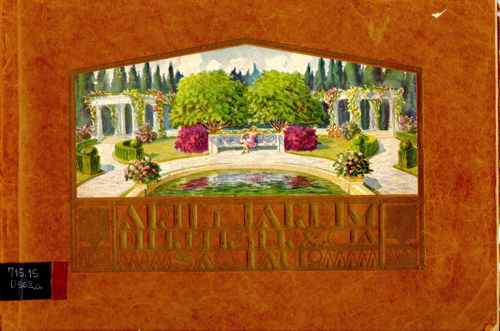
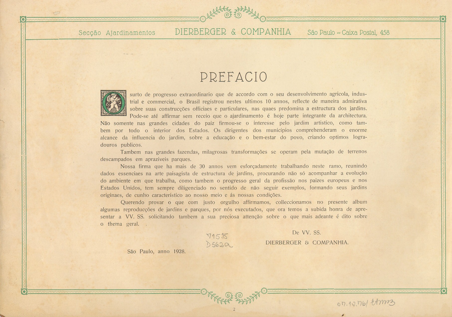
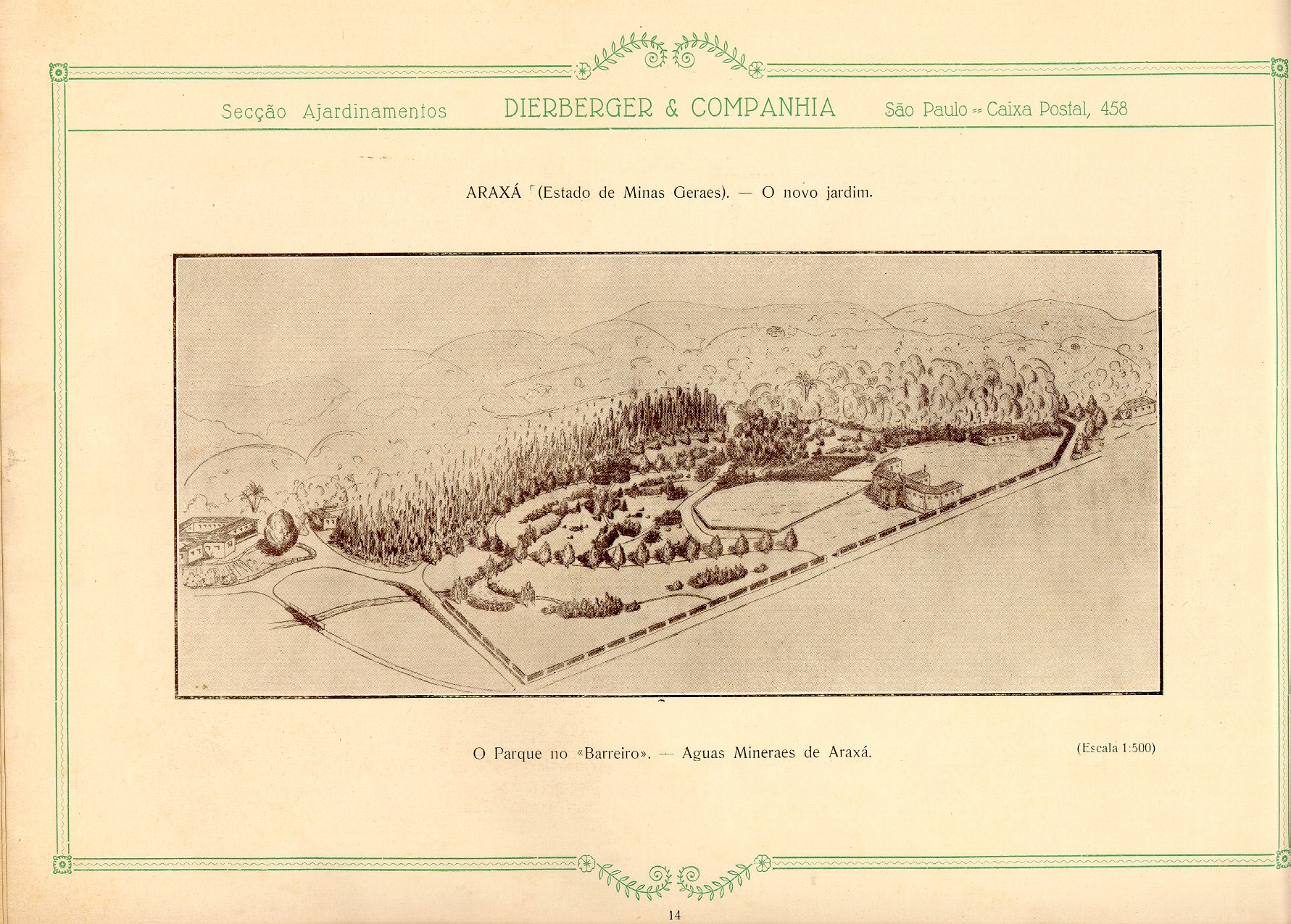
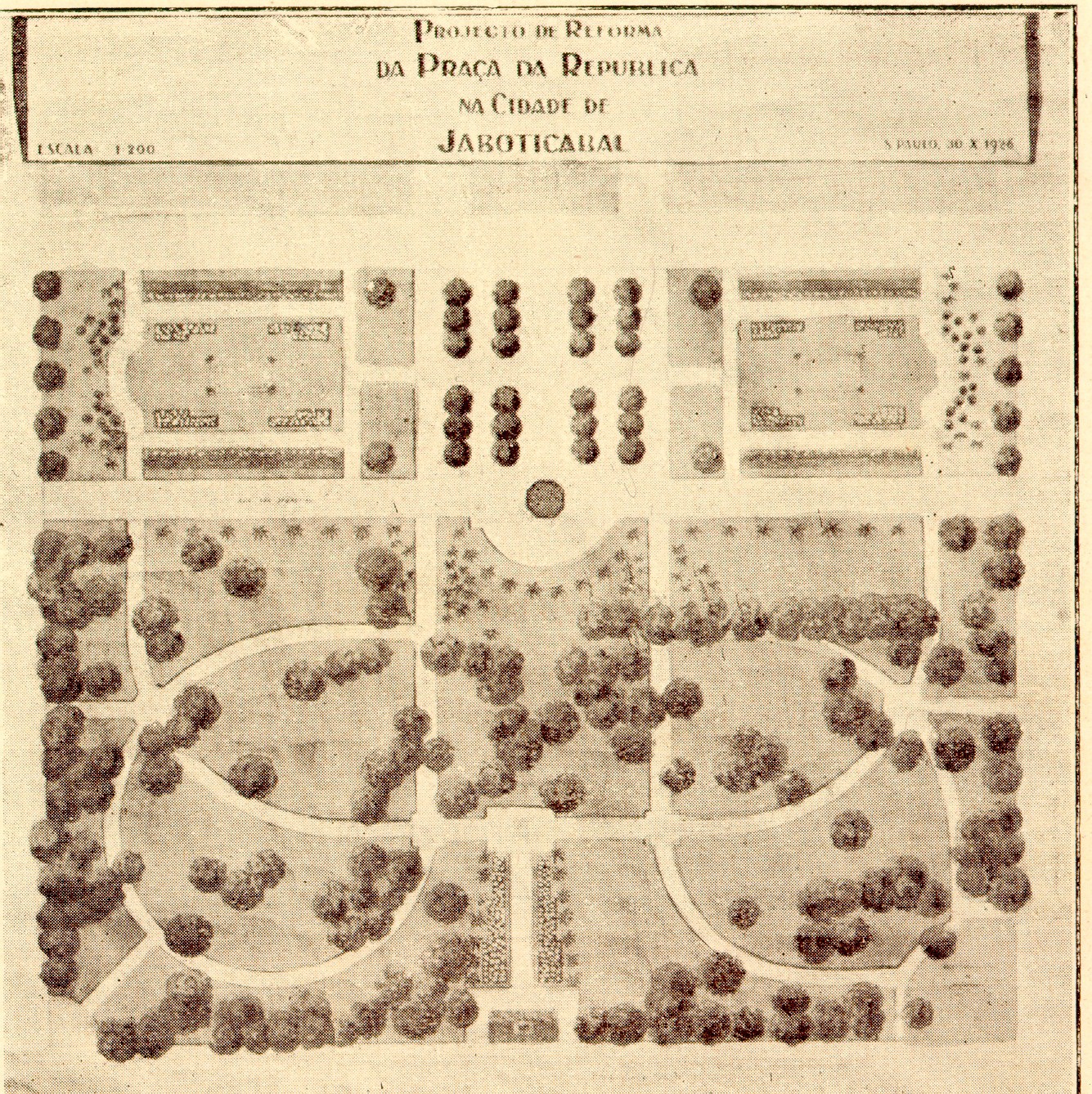
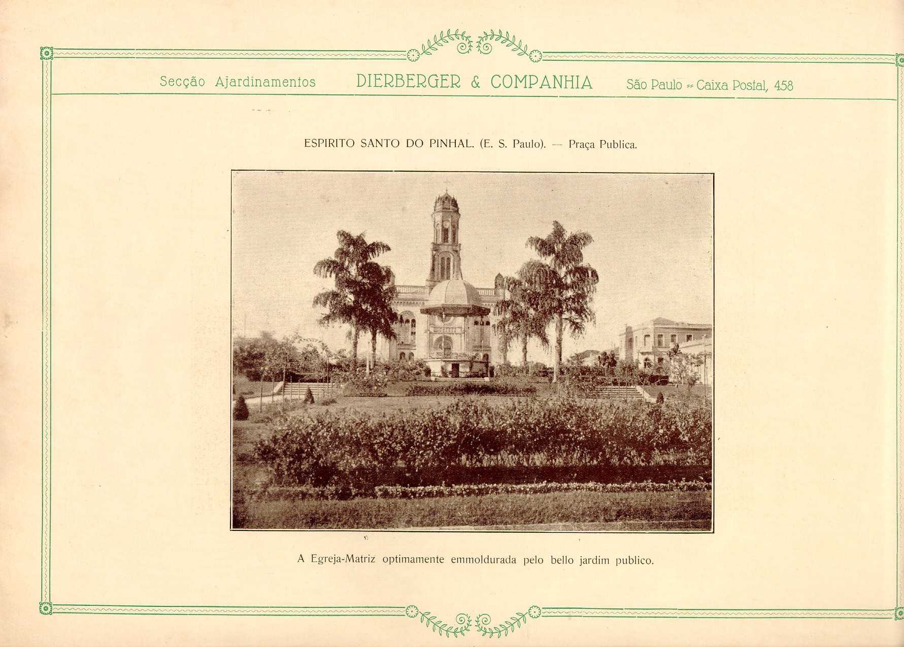
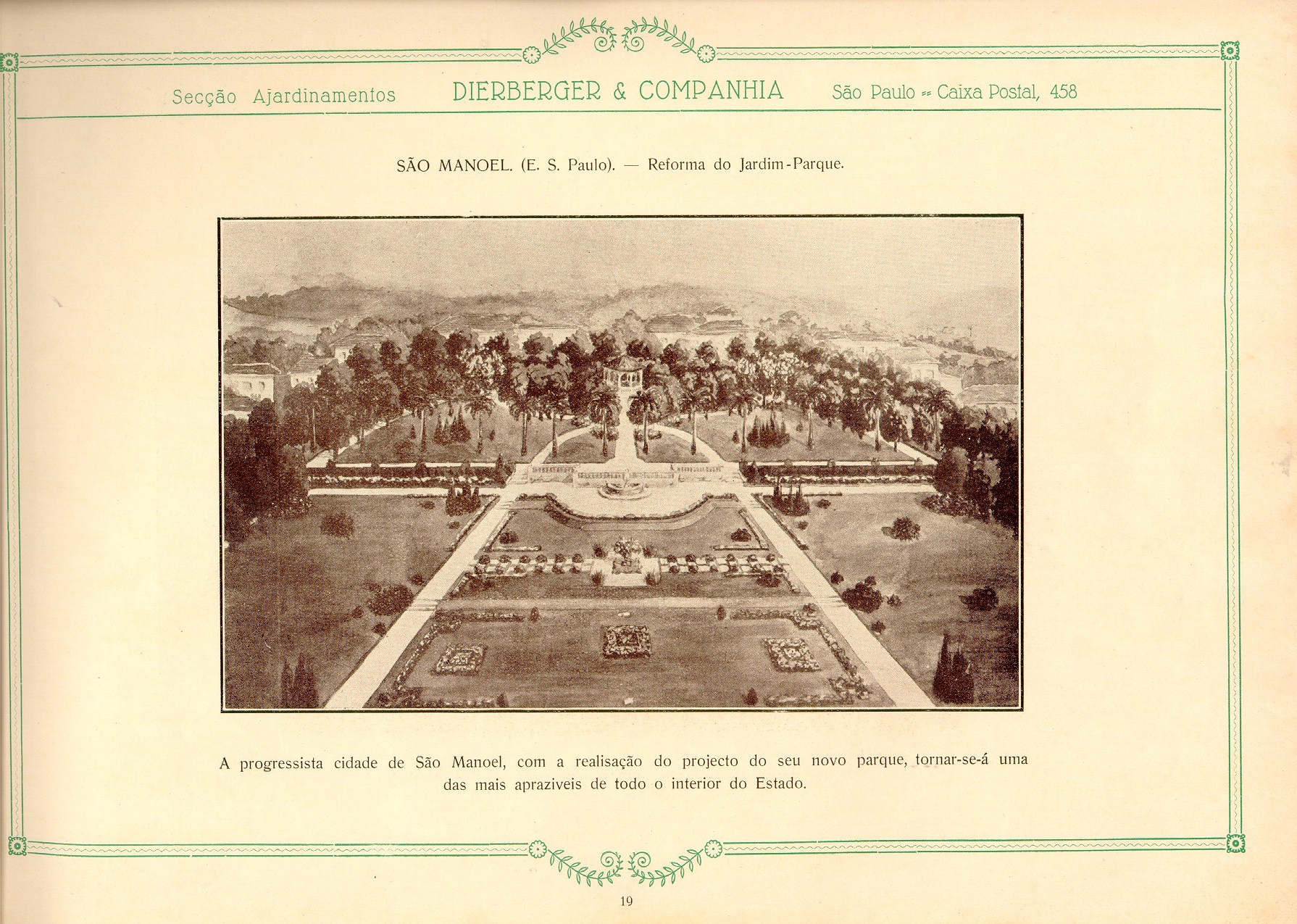
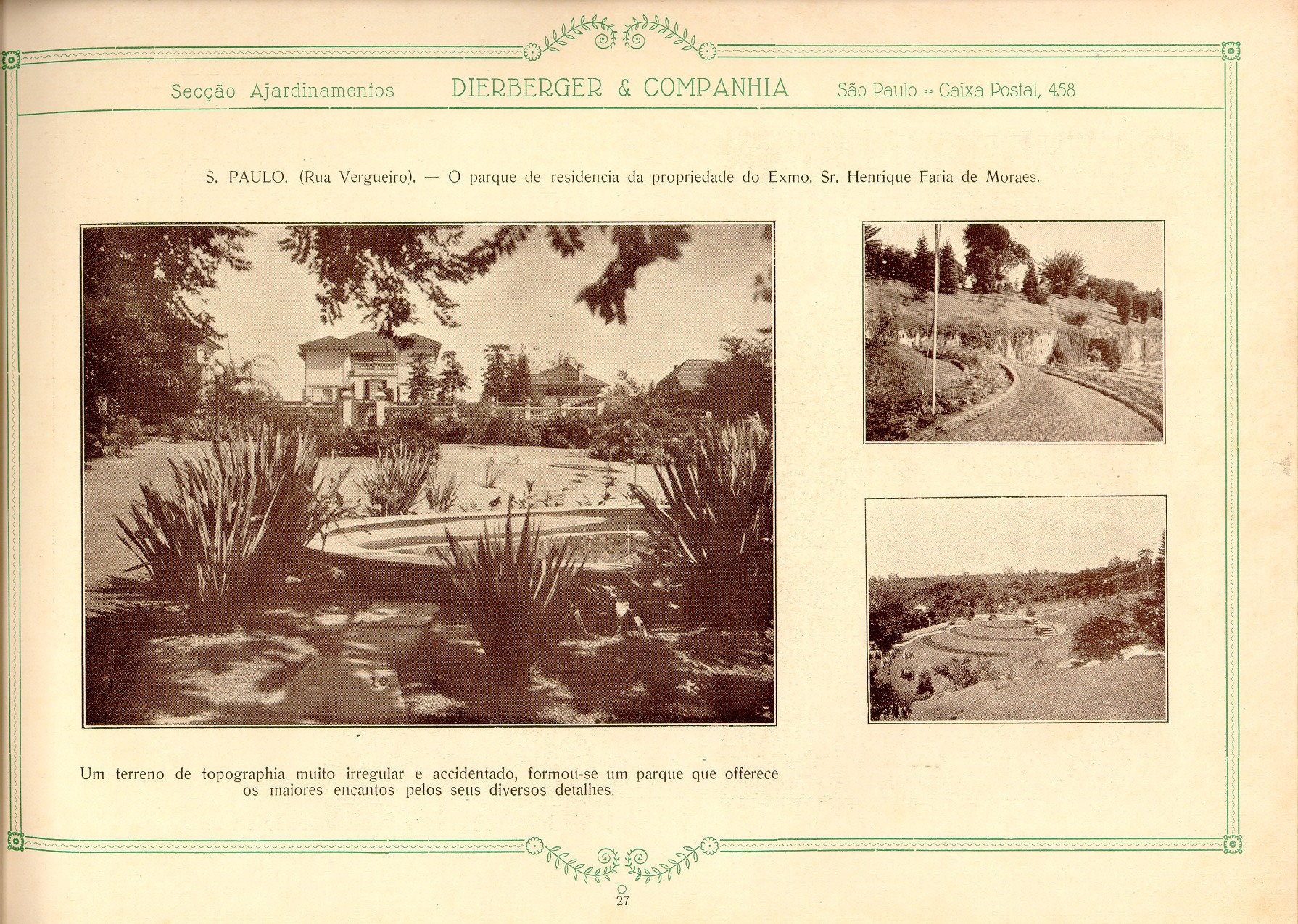
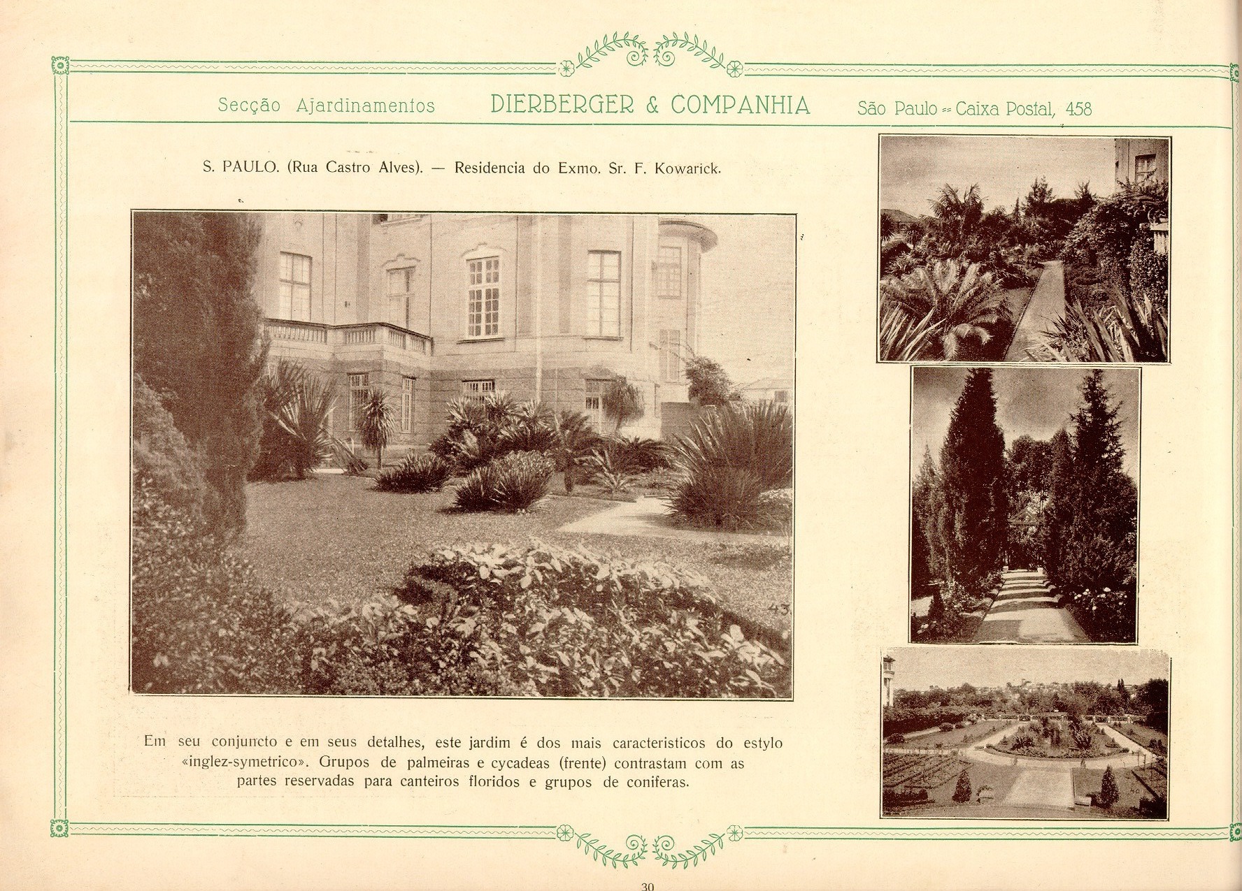
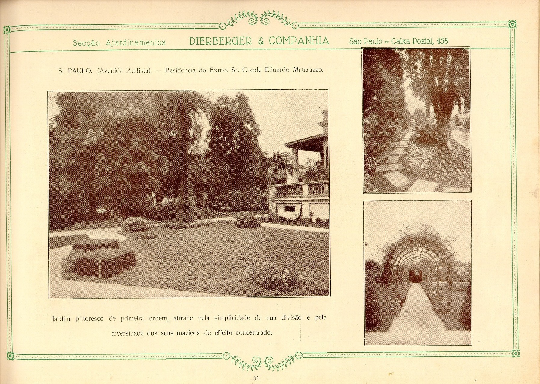
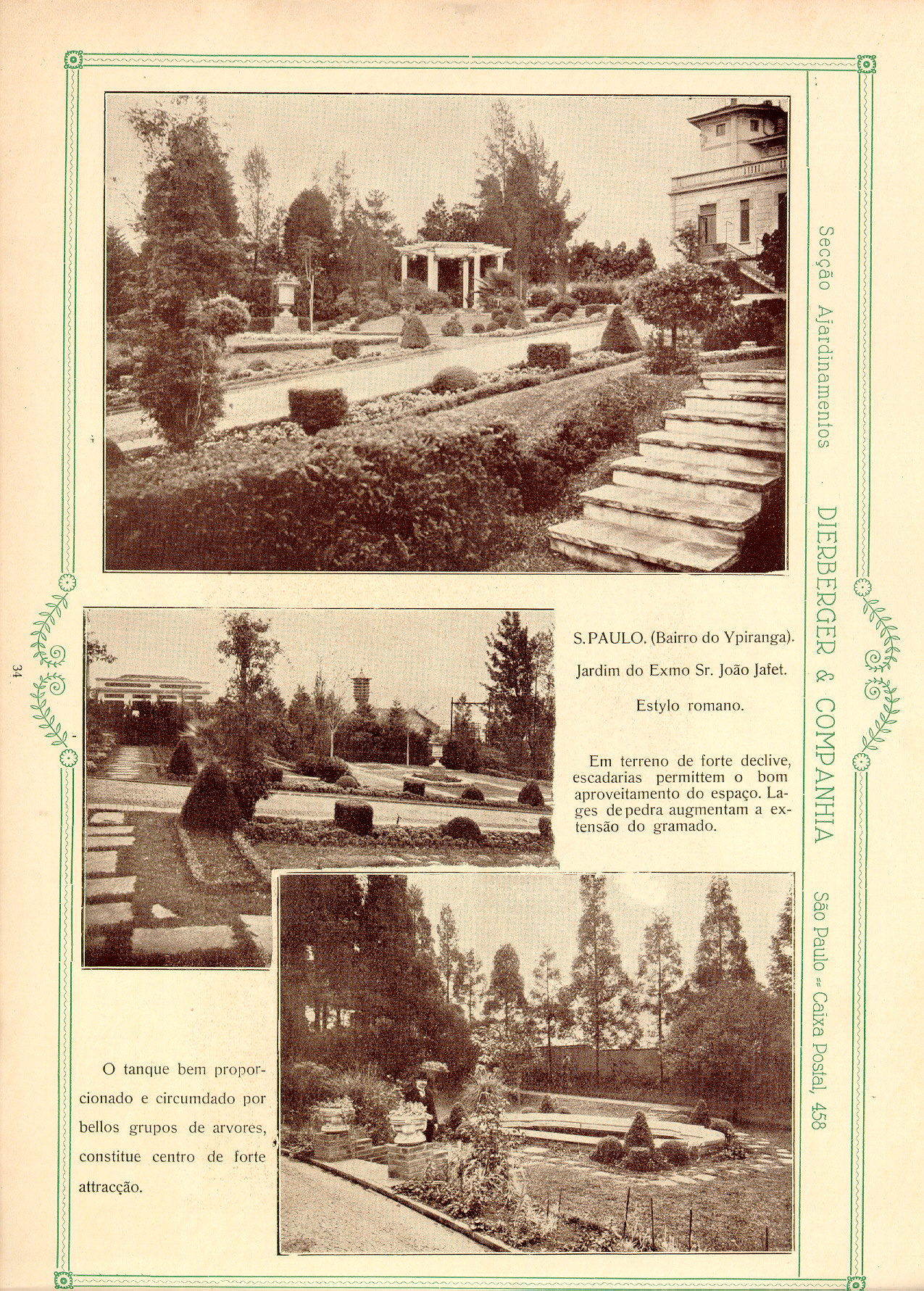
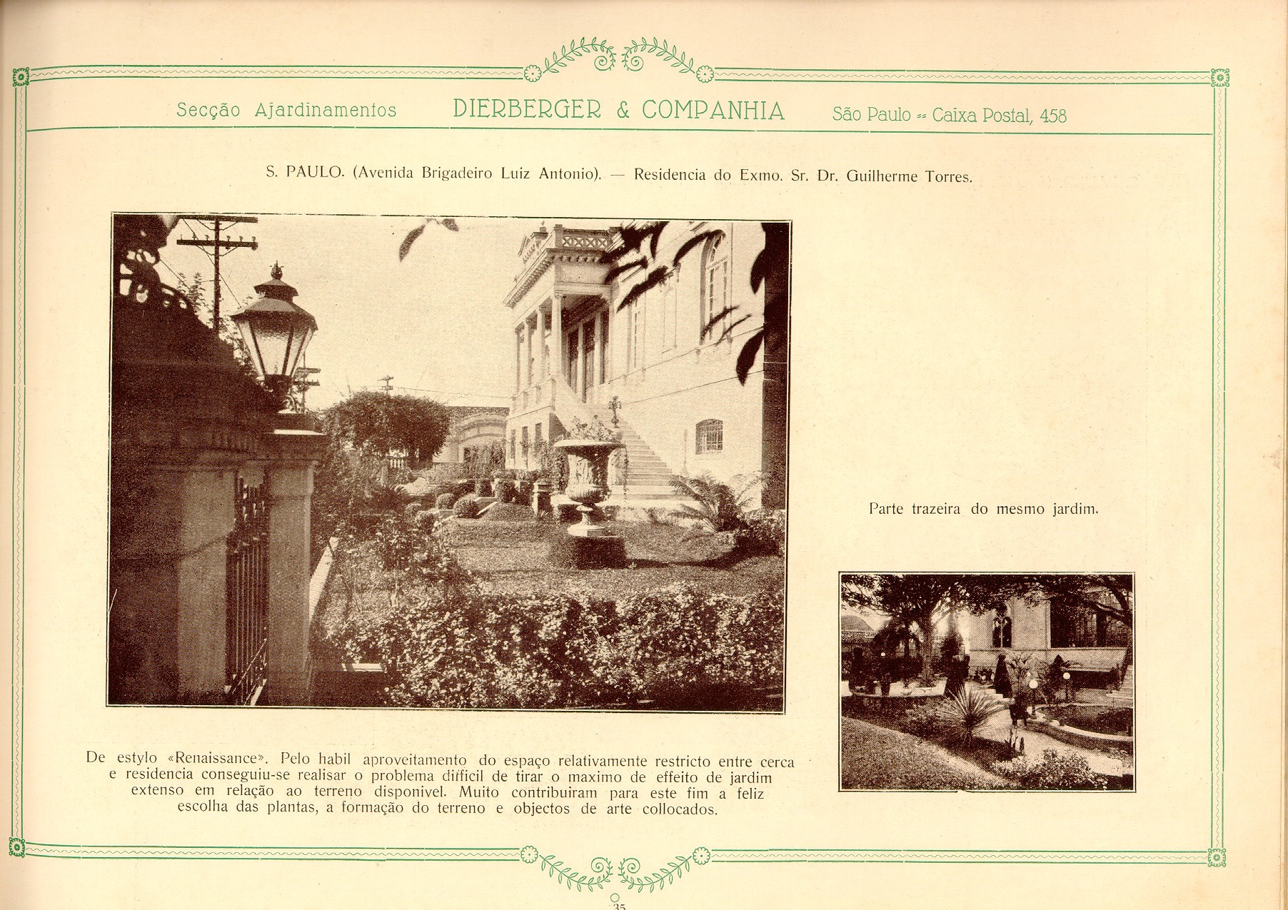
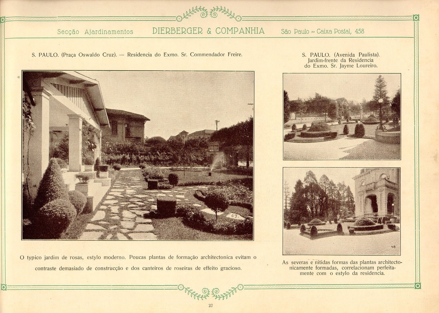
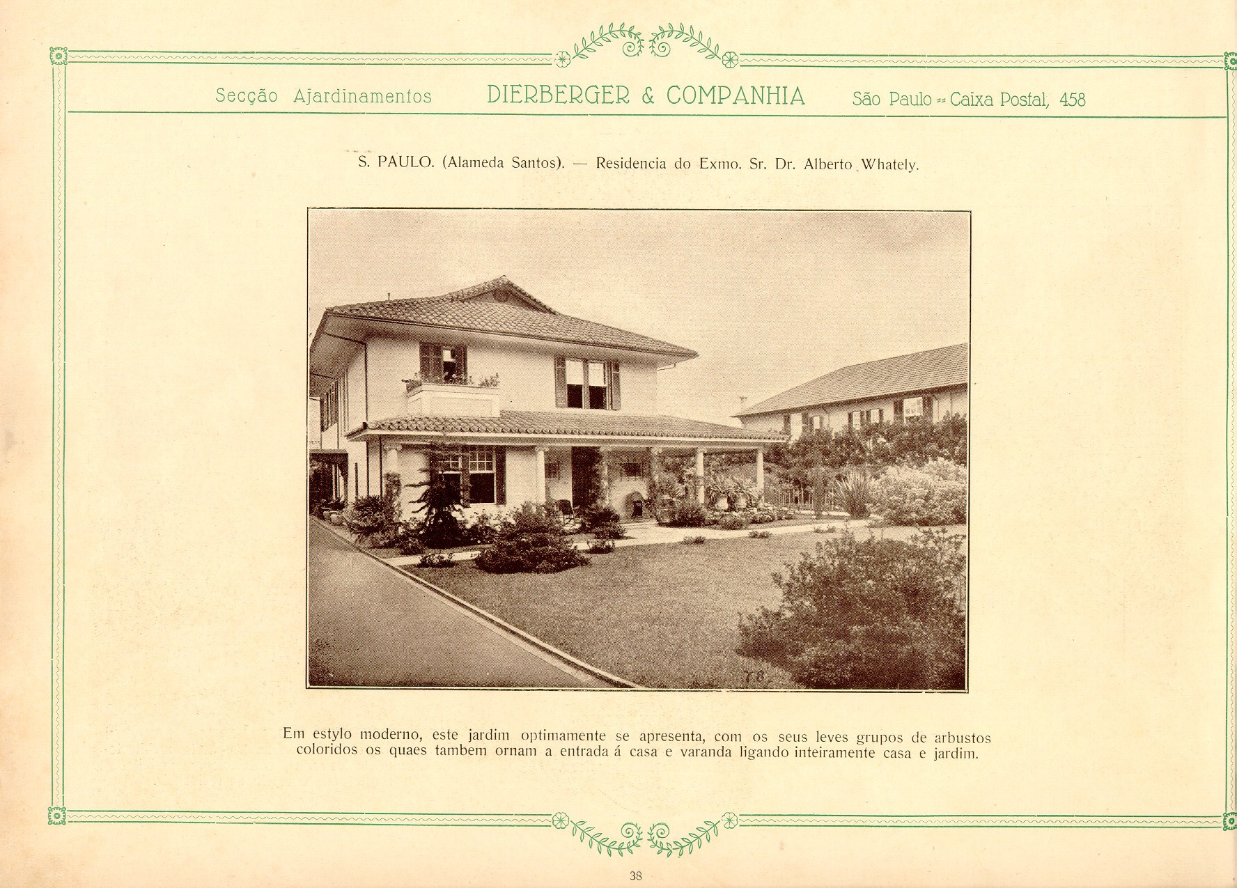
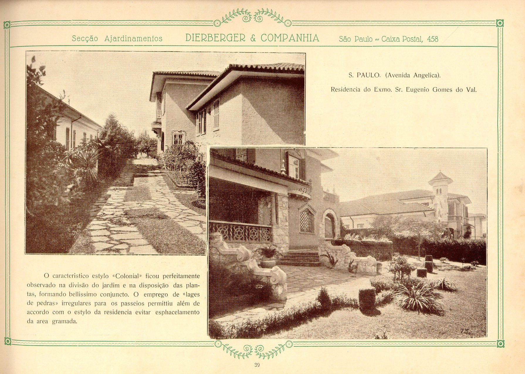
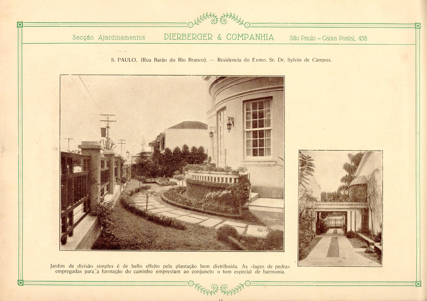
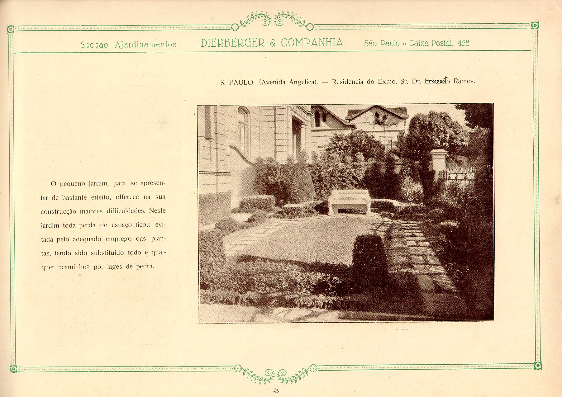
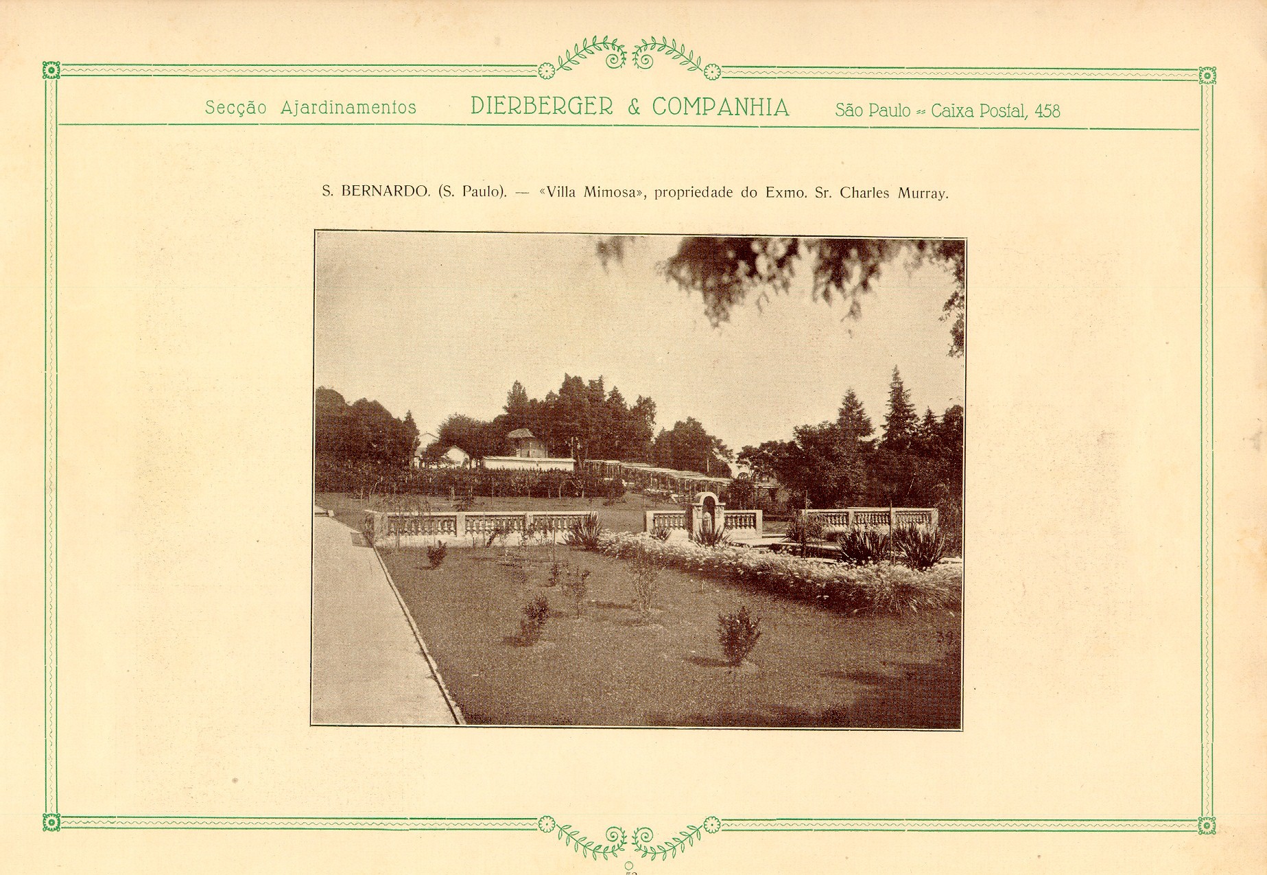
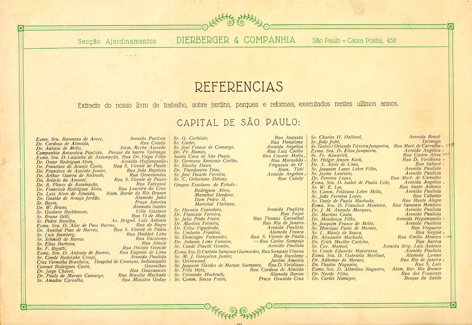
Datado de 1928, o livro Dieberger & Companhia: arte e jardim foi digitalizado e inserido neste post. O material, apesar de sua linguagem datada, é precioso pois mostra a passagem dos ajardinamentos tidos como ornamentos ou ainda coadjuvantes dos edifícios para um papel principal interagindo e integrando-se ao projeto de arquitetura nas palavras de Dieberger.
O manual, como é chamado pelo autor, apresenta uma coletânia de projetos de jardins residenciais e parques, além de um capítulo dedicado à definição do conceito de jardim praticado por sua companhia.
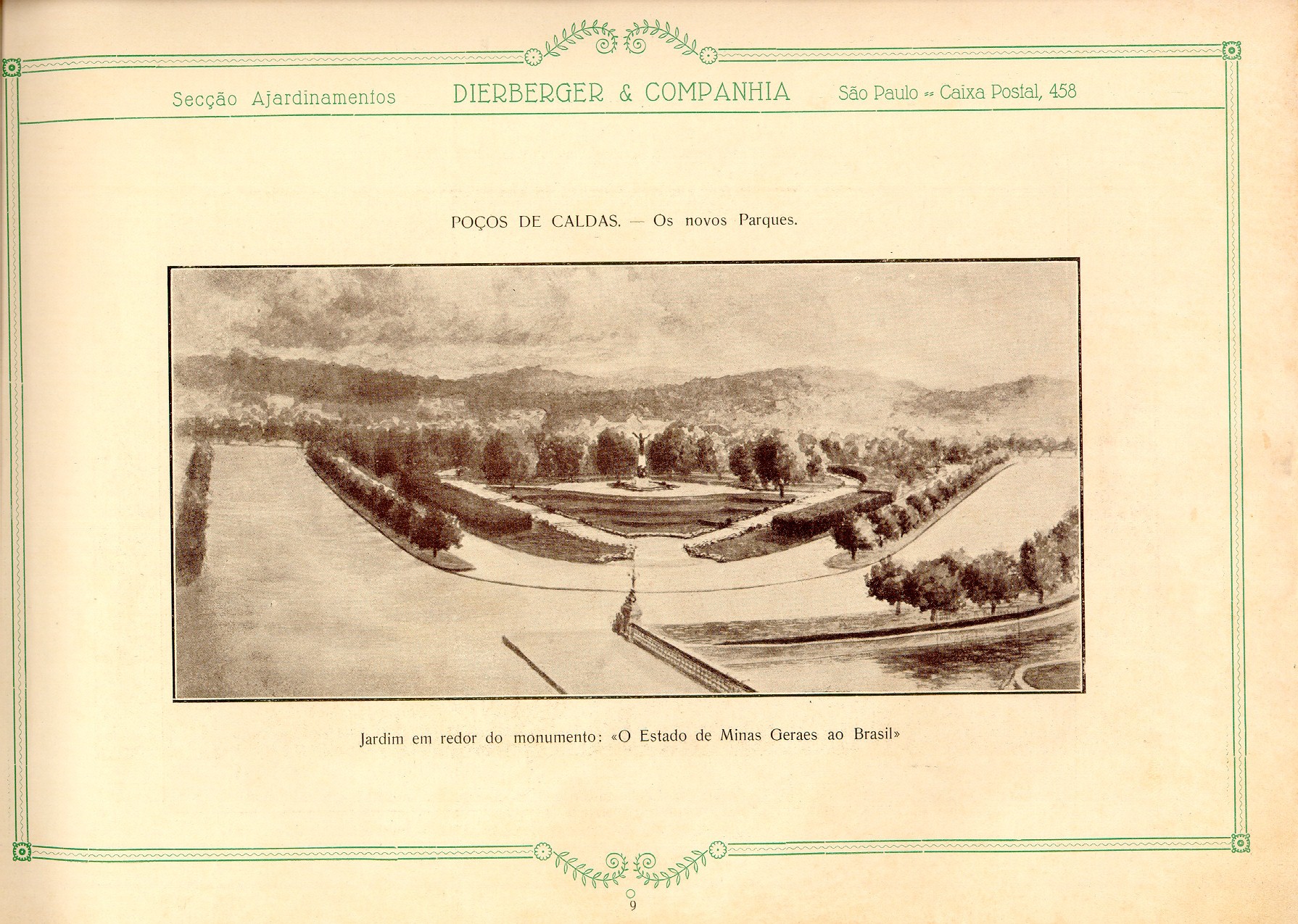
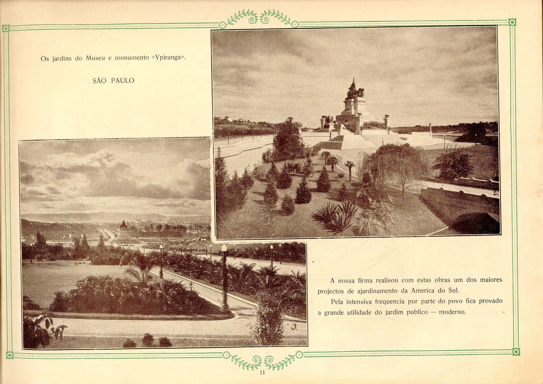
Costumo utilizá-lo em aulas para mostrar o desenvolvimento das linguagens de projeto e também para falar um pouco mais sobre o uso da vegetação.
Como não me lembro de ter visto exemplares à venda, achei que talvez após 82 anos não haveria problema algum em disponibilizar o material. Não sei quem digitalizou, mas agradeço de qualquer forma pois posso utilizá-lo para ensinar.
A partir de um acordo de cooperação técnica celebrado entre o Curso de Arquitetura e Urbanismo do Centro Universitário FIAM-FAAM e a Subprefeitura Jaçanã-Tremembé, esta proposta estudantil faz parte de um conjunto de projetos que deverão compor o Parque Linear Cabuçu de Cima.
Cliente: Subprefeitura Jaçanã
Local: Parque Linear Cabuçu de Cima
Alunos: Mariana Montelli (msmontelli@gmail.com)
Nadia Bigliassi (nadiabigliassi@hotmail.com)
Tutor: Drª Helena Degreas
Desenvolvido pelos alunos do Escritório Modelo Digital do Curso de Arquitetura e Urbanismo do Centro Universitário FIAM-FAAM, o trabalho avaliou as condições de acessibilidade sob uma ótica singular de alguns dos pontos turísticos mais antigos da cidade de São Paulo: Parque da Luz, Estação da Luz, Museu da Lingua Portuguesa e Pinacoteca do Estado.
Situações-Problema proposta ao grupo:
– É possível a um turista com mobilidade reduzida fazer o mesmo roteiro cultural (com um dia de duração) que um turista sem problemas de mobilidade?
A partir deste ponto, os alunos avaliaram as possíveis formas de acesso de um turista (metrô, automóvel particular, trem, taxi, ônibus, estacionamentos, etc), e as características de ingresso aos edifícios avaliados a partir de sua chegada (acesso frontal, lateral, barreiras, etc.).
A partir daí, definiram o seguinte roteiro cultural:
– Estação da Luz, Museu da Lingua Portuguesa, Pinacoteca do Estado e Parque da Luz.
Formas de Acesso:
– Metrô Luz, CPTM, Auto particular, táxi, transporte coletivo, estacionamentos.
Objetivos O presente trabalho tem por objetivo levar o aluno a compreender os papéis desempenhados pelos parques na cidade de São Paulo, reconhecendo sua diversidade de formas, contextos, usos e funções. O trabalho terá papel colaborativo, ou seja, a partir da postagem das diversas pesquisas, os alunos poderão ampliar seus conhecimentos sobre esse tipo de espaço livre urbano.
Relação dos Parques Os alunos deverão selecionar um dos parques citados na lista abaixo, informando ao professor a sua escolha.
Alfredo Volpi
Rua Engenheiro Oscar Americano, 480 – Cidade Jardim/ Morumbi 11 3031-7052
Trote
Av Nadir Dias de Figueiredo, s/n – Vila Guilherme 11 2965-0165
Parque do Trote (autor: PMSP)
Victor Civita
Rua Sumidouro, 580 – Pinheiros 11 3037-8696/ 3031-3689
Zilda Natel
R. Cardoso de Almeida com a Av. Dr. Arnaldo
Linear Sapé
Localização: Rod Raposo Tavares até Av Eng Politécnico – Butantã
Tarefa
A tarefa consiste na realização de um levantamento técnico com as seguintes informações:
-planta
-foto aérea
-descrição do programa de atividades e usos;
-circulações de pedestre (calçada, trilhas, rampas, escadas, passarelas)
-circulações de veículos (ciclovia, via local, via de serviço, estacionamento, emergência)
-pontos de ônibus, van, taxis.
-atividades de recreação e permanência ativa
–futebol society, campo, poliesportiva, tênis, pipa e aeromodelismo, skate, patins, esportes aquáticos, artes marciais, pedalinho, área infantil, pingpong, xadrez, bocha.
-atividades de recreação passiva e seus usos:
-deck, canteiro, anfiteatro,concha acústica, teatro de arena, estar/gramado, tomar sol, praia, meditação, religioso, contemplação, educação, jogos de mesa, alimentação, eventos, mirante, administração, manutenção.
-descrição dos usos da vegetação na composição de espaços.
Recursos para elaboração das tarefas Os trabalhos poderão utilizar ilustrações, vlogs, podcasts, fotologs e links.
Registro do Trabalho A apresentação será realizada por meio da postagem do material em http://helenadegreas.com.br
Prezados alunos da Disciplina: Introdução ao Projeto de Paisagismo,
bem-vindos ao nosso novo trabalho de pesquisa!
Parques urbanos: acervo QUAPASEL
Esta etapa de trabalho será dividida em três partes e terá a duração de duas semanas, servirndo de suporte para uma elaboração consciente do nosso conceito, programa, partido e projeto de parque.
O primeiro trabalho deverá ser realizado individualmente. Trata-se de uma pesquisa sobre o conceito de parque no Brasil e no mundo. O trabalho é colaborativo ou seja, a pesquisa de um dos membros da classe necessariamente deverá trazer novas abordagens, esclarecendo dúvidas ou reavaliando o material postado pelos demais alunos. Funcionará como um termo wiki.
Os demais trabalhos serão postados após a finalização deste.
Todas as citações, referências, ilustrações, vídeos, endereços eletrônicos obedecerão a NBR6023.
INICIANDO NOSSA PESQUISA
Tema
Os parques são equipamentos urbanos e fazem parte do sistema de espaços livres das cidades brasileiras. Na história do urbanismo, sua implantação no mundo generalizou-se a partir do século XIX abrigando vários usos e funções que as sociedades foram lhe atribuindo ao longo do tempo assumindo uma espécie de plurifuncionalidade. Pode-se afirmar que esta “acumulação” de usos e funções também seja responsável pelos diversos sentidos que estes espaços têm e também pelas diversas formas que assumem contemporaneamente.
Assim, solicita-se dos alunos que pesquisem e reflitam sobre o que é ou o que pode vir a ser um parque urbano hoje na cidade de São Paulo.
Vocês deverão postar suas pesquisas utilizando o campo comentários e aguardar a mediação do professor.
Objetivo do trabalho: Compreender o significado do conceito Parque hoje.
Questões que deverão ser abordadas em seu trabalho:
_ o que é parque?
_ a que época pertence o conceito por você citado?
_ a que país, cidade ou região se refere esse conceito?
_ quem o criou? (citar fonte como por exemplo, Prefeitura do município de XXX, ou ainda, Dicionário, etc.)
_ que usos e funções o texto cita para ilustrar o conceito?
_as imagens por você inseridas ilustram o conceito por você descrito?
Para fins de avaliação os professores levarão em conta:
_qualidade das fontes de consulta
_respeito à NBR6023
_respeito às regras gramaticais
_questões respondidas
_ilustrações
Bibliografia: MACEDO, Silvio Soares in “Quadro do Paisagismo no Brasil”, São Paulo, 1999
MACEDO, Sílvio Soares “Espaços Livres”, in Paisagem e Ambiente n°7, São Paulo, 1995
MACEDO, Silvio Macedo & SAKATA, Francine Gramacho. Parques Urbanos no Brasil. São Paulo:Edusp


")
")
")
")
")
")
")
")


")
")
")
")
")
")
")
")
")
")
")

